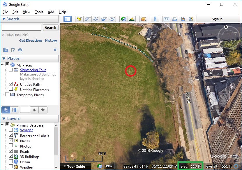
Google Earth is a great way to estimate the height of nearby obstacles. Here’s the method I use to estimate my RTH altitude to ensure I clear all obstacles in my flight path:
1) Find the elevation at the takeoff location. In my example below, the takeoff location is the red circle and the elevation at that point is 110 feet.
2) Scroll around on the map in Google Earth and find the tallest obstacle in the area. In my example below, the tallest obstacle is the top of this building (the red circle). It has an elevation of 597 feet.
3) Calculate the best RTH altitude for this flight. In this case, 487 feet (597 feet minus 110 feet) is the tallest obstacle in the area above the takeoff location. I’d then add at least 50 feet to that value since I know the IMU is only able to estimate the current altitude (it’s never 100% accurate). That means the RTH altitude for this flight would need to be set to at least 537 feet (164 meters).
